Cinque Terre Hiking Guide: Trail Difficulty Levels and Coastal Path Closures
The cliffside villages of the Ligurian coast have lured hikers from around the world, promising dramatic vistas where turquoise Mediterranean waters meet terraced vineyards. But Cinque Terre hiking isn’t just about showing up with a camera—it’s about understanding trail conditions, difficulty ratings, and those frustrating-but-necessary path closures that can make or break your adventure. Whether you’re eyeing the famous coastal route or venturing into the lesser-known mountain paths, knowing what to expect before you lace up your boots is essential for an unforgettable trekking experience.
Understanding Cinque Terre Hiking Trails: Overview and Access
The Cinque Terre trails system encompasses over 120 kilometers of pathways managed by the Cinque Terre National Park, ranging from gentle coastal strolls to challenging mountain ascents. Unlike many hiking destinations, certain cinque terre trekking routes require a Cinque Terre Card—essentially a national park passes that grants access to maintained trails, primarily the Sentiero Azzurro coastal segments. This ticketing system exists because the park actively maintains these heavily-trafficked paths, installing steps, handrails, and erosion controls that protect both hikers and the fragile landscape.
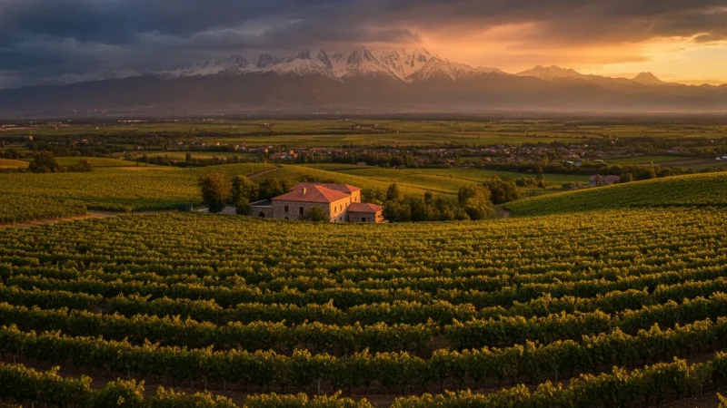
The trail network divides into two main categories: coastal paths that connect the five villages at sea level, and mountain trails that climb into the terraced hillsides above. Mountain routes are generally free to access, while the coastal Sentiero Azzurro sections require the park card during peak season (typically March through October). The best time to hike Cinque Terre falls between April and June or September and October, when temperatures are moderate, crowds thinner, and trail maintenance updates have addressed winter damage. Summer brings scorching heat and tourist masses, while winter sees frequent closures due to storms. If you’re planning other epic hikes, check out our Kilimanjaro Hiking Guide for another bucket-list trekking destination.
Sentiero Azzurro and Coastal Paths: Difficulty Levels and Current Status
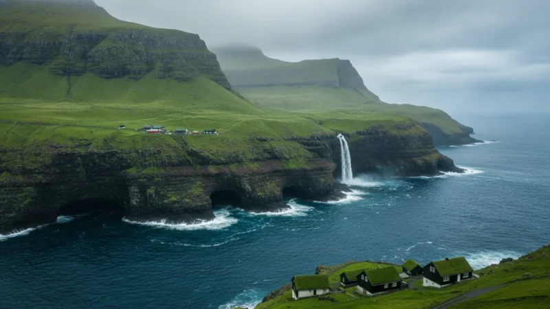
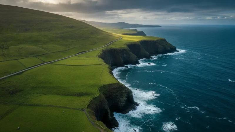
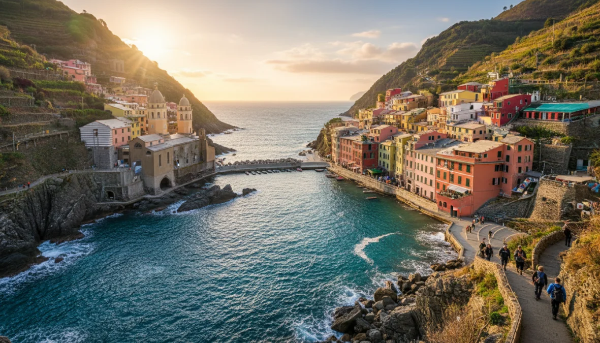
The Sentiero Azzurro (Blue Trail) is the crown jewel of coastal hiking Italy experiences—a spectacular pathway hugging the cliffs between all five villages. However, calling it “one trail” oversimplifies reality. The blue trail cinque terre actually consists of four distinct segments, each with dramatically different difficulty levels and closure histories. Understanding these individual sections is crucial for planning your hiking path cinque terre adventure.
Via dell’Amore and Coastal Segments: Trail Conditions
The Via dell’Amore connecting Riomaggiore to Manarola (1 km, 20 minutes) is the easiest segment—a paved, largely flat walkway carved into the clifface. After years of closure following a 2012 landslide, it has partially reopened with limited access. This romantic pathway requires cinque terre hiking permits required via the park card and features protective tunnels and ocean-view benches. Difficulty: Easy (T-Turistico).
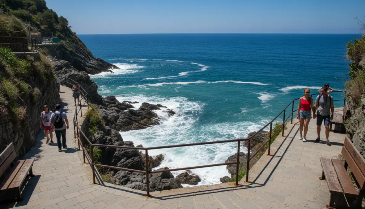
The Manarola to Corniglia segment (3.5 km, 90 minutes) climbs more aggressively through vineyards with exposed sections and uneven steps. This section experiences cinque terre hiking trail closures frequently, especially after heavy rains. When open, it offers stunning agricultural terraces but demands moderate fitness. Difficulty: Medium (E-Escursionistico).
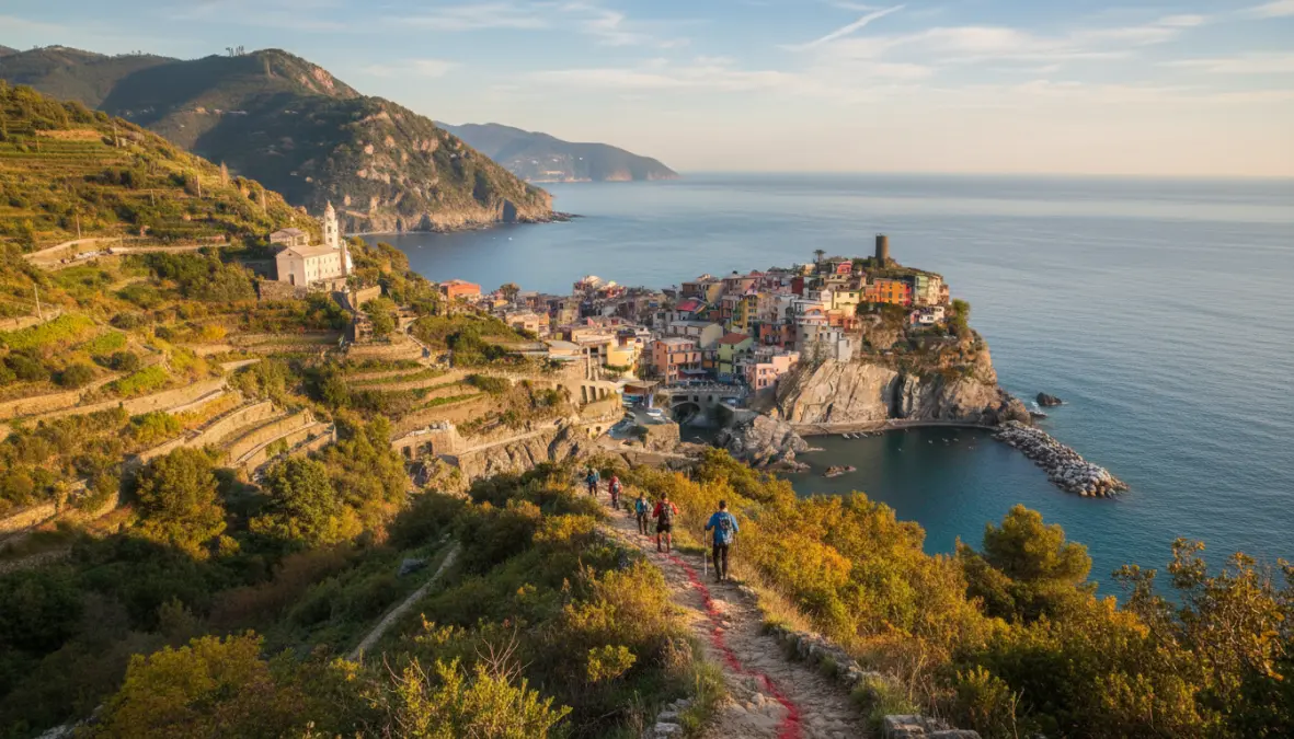
Corniglia to Vernazza (3.5 km, 2 hours) represents the most challenging coastal segment, with steep ascents, rocky terrain, and minimal shade. You’ll climb approximately 200 meters up and then descend sharply into Vernazza—a workout that leaves many huffing. Hiking boots recommended for this technical section with loose stones and exposure. Difficulty: Medium-Hard (E).
The Vernazza to Monterosso stretch (3.5 km, 2 hours) offers moderate-to-high difficulty with significant elevation changes through terraced landscapes. Well-maintained steps and spectacular coastal panoramas make this many hikers’ favorite section. It’s generally more stable than the Manarola-Corniglia segment, though summer heat can be punishing. Difficulty: Medium (E).
Path Closures and Real-Time Updates
The cinque terre coastal path conditions change frequently due to the region’s geological instability. Landslides, erosion, and storm damage regularly force temporary closures—particularly during autumn and winter months. Before hiking, always check the official Cinque Terre National Park website (parconazionale5terre.it) for current status updates. Visitor centers in each village also post daily trail conditions, and several apps provide real-time closure information.
Common closure triggers include heavy rainfall (which destabilizes cliff faces), ongoing trail maintenance updates, and rockfall risks. If your planned route is closed, don’t despair—the efficient train service connects all five villages in minutes, allowing you to skip closed sections or explore alternative mountain trails instead. The most reliable period with fewest closures runs May through early October, though no season guarantees full access.
Alternative Mountain Trails and Difficulty Ratings
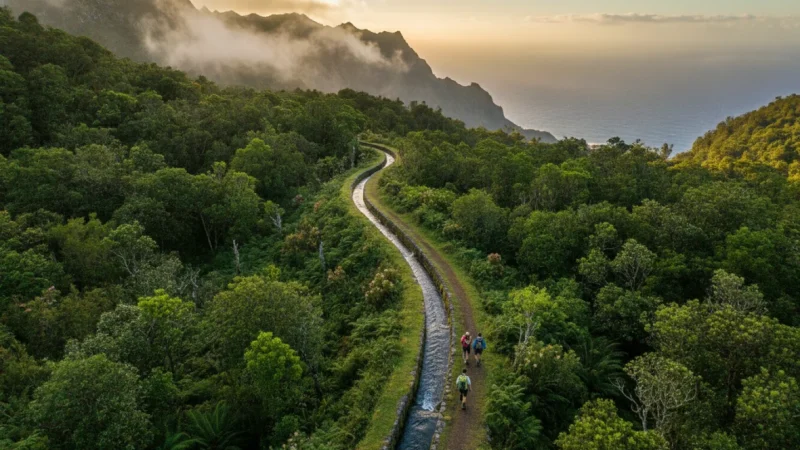
Beyond the famous coastal route, the Cinque Terre trails network includes spectacular mountain paths that most tourists overlook. These high-altitude alternatives offer solitude, expansive views, and connections to historic sanctuaries perched above the villages. The Sentiero Rosso (Red Trail or High Trail #1) traverses the ridgeline from Monterosso to Riomaggiore via mountain sanctuaries, covering approximately 40 kilometers with significant elevation gain. This full-day or multi-day trek demands strong fitness and navigation skills, rewarding experienced hikers with panoramic Ligurian coast vistas without coastal crowds. Difficulty: Hard (EE-Escursionisti Esperti).
The Sentiero 2 (Sentiero della Cresta) follows an even higher ridge, offering advanced cinque terre trekking through chestnut forests and alpine meadows. Individual sanctuary trails provide shorter options—like the climb from Vernazza to Santuario di Reggio or Riomaggiore to Santuario di Montenero—perfect half-day excursions mixing spiritual heritage with physical challenge.
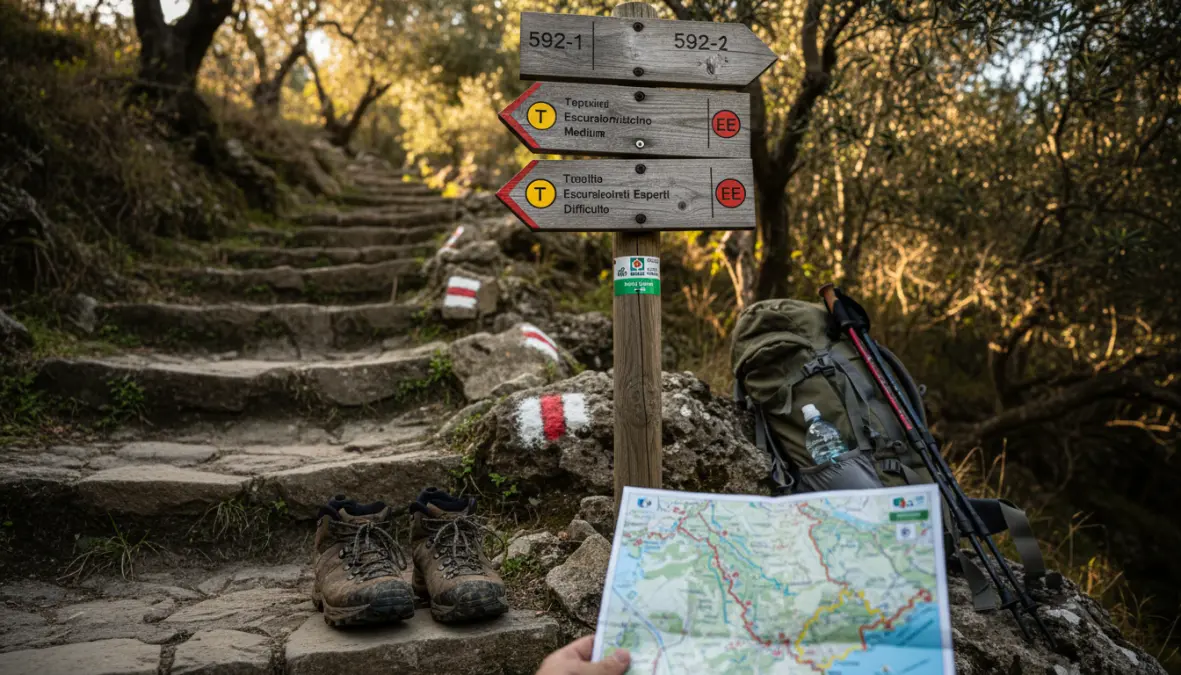
The Italian Alpine Club uses a three-tier difficulty system: T-Turistico (tourist-friendly, minimal elevation, maintained paths), E-Escursionistico (hiking experience helpful, moderate climbs, potentially rough terrain), and EE-Escursionisti Esperti (expert hikers only, significant exposure, navigation skills essential). Most mountain trails fall into E or EE categories. Essential gear includes sturdy hiking boots with ankle support, at least 2 liters of water per person, sun protection, and a detailed trail map—GPS signal can be unreliable in valleys. For more responsible hiking practices, explore our Sustainable Travel Guide.
FAQ: Cinque Terre Hiking Essentials
Do I need a ticket to hike Cinque Terre?
Only for Sentiero Azzurro coastal segments during peak season (March-October). Mountain trails are free. The Cinque Terre Card costs around €7.50 per day and includes trail access plus some bus services.
Which is the easiest Cinque Terre trail?
Via dell’Amore between Riomaggiore and Manarola is the easiest hiking trail cinque terre, being mostly flat and paved. When closed, Vernazza-Monterosso offers the gentlest grade among longer segments.
Is Via dell’Amore open?
Partially reopened with restricted access and timed entry. Check the official park website for current status, as conditions change based on ongoing restoration work.
Can I hike Cinque Terre in one day?
Technically yes—how long to hike cinque terre coastal path takes 5-7 hours walking time—but it’s exhausting. Most hikers prefer 2-3 days to enjoy villages and account for potential closures.
What is the hardest trail in Cinque Terre?
The Sentiero Rosso high route (Trail #1) presents the greatest challenge, with sustained elevation gain, technical sections, and 8+ hours hiking time.
Are Cinque Terre trails well marked?
Coastal Sentiero Azzurro is excellently marked. Mountain trails have standard red-white blazes but require more attention to navigation, especially at intersections.
The magic of cinque terre hiking lies not just in the Instagram-worthy coastal views, but in understanding this living landscape’s temperamental nature. Trail closures aren’t inconveniences—they’re necessary protections for both hikers and the fragile cliffs that make this coastline extraordinary. Come prepared with backup plans, respect closure signs, and consider the quieter mountain routes that reveal the region’s agricultural soul beyond the postcard villages. Whether you’re tackling the challenging Corniglia-Vernazza ascent or strolling the romantic Via dell’Amore, these ancient pathways connecting stone villages offer hiking experiences found nowhere else on Earth. If you’re inspired to explore more European adventures, our European Spring City Break Guide provides excellent complementary destinations to your Ligurian adventure.